Qu'est-ce que le GPS ? : Exploration des applications multiformes des systèmes de positionnement global
Table of Contents
- Introduction
- How GPS Works for the Operator
- Tactical Land Navigation
- Personnel and Team Tracking
- Asset Protection and Recovery
- Emergency Signaling and Search and Rescue (SAR)
- Technical Considerations for Gear Selection
- Step-by-Step: Setting Up a GPS Tracking System for Your Vehicle
- Integrating GPS into Your EDC
- Common Myths and Mistakes
- The Future of GPS and Tactical Tech
- Summary Checklist for Tactical GPS Use
- Conclusion
- FAQ
Quick Answer: Global Positioning System (GPS) is a satellite-based navigation system used for precise positioning, navigation, and timing. For operators and preppers, it is primarily used for land navigation, tracking high-value assets, coordinating team movements, and providing emergency distress signals in remote environments.
Introduction
In a high-stakes environment, knowing exactly where you stand—and where your team is—can be the difference between mission success and total failure. Whether you are navigating a dense forest during a patrol, tracking a stolen vehicle, or coordinating a search and rescue operation, the Global Positioning System (GPS) is the backbone of modern situational awareness. Most people think of GPS as just the blue dot on their phone that helps them find a coffee shop. For us at Crate Club, GPS is a critical tool that provides precision data when the margin for error is zero.
We rely on this technology to maintain operational security and ensure that gear, personnel, and vehicles remain accounted for. This guide covers the technical foundations of GPS, its primary tactical applications, and how to select the right gear for your loadout. Understanding how to leverage this system effectively is a fundamental skill for any serious tactician or survivalist.
How GPS Works for the Operator
To use a tool effectively, you have to understand how it functions. GPS is a network of over 30 satellites orbiting the Earth at approximately 12,500 miles. These satellites constantly broadcast signals that include the satellite's position and the exact time the signal was sent.
Trilateration is the mathematical process your receiver uses to determine your location. To get a 2D fix (latitude and longitude), your device needs signals from at least three satellites. To get a 3D fix (adding altitude), it needs a fourth.
Signal Accuracy and GNSS
While we commonly use the term GPS, it is actually just the US-owned portion of a broader category called GNSS (Global Navigation Satellite System). Other systems include Russia's GLONASS, Europe's Galileo, and China's BeiDou. High-end tactical receivers often "talk" to multiple systems simultaneously. This increases accuracy, especially in "urban canyons" or deep ravines where the view of the sky is limited.
Field Note: Most consumer-grade GPS units are accurate to within 15 to 30 feet. However, atmospheric conditions, signal bouncing (multipath interference), and heavy canopy can degrade this. Always carry a lensatic compass and a physical map as a redundant backup.
Tactical Land Navigation
The most common use for GPS in the field is land navigation. For the modern operator, this goes far beyond following a line on a screen.
Waypointing and Route Planning
A waypoint is a specific set of coordinates marked in your device’s memory. In a tactical context, these are used to mark Rally Points (RP), Objective Rally Points (ORP), caches, or extraction zones.
- Breadcrumbing: This feature records your path as you move. If you need to egress through the same route to avoid known threats or obstacles, you follow your digital "breadcrumbs" back.
- MGRS Support: Serious tactical units use the Military Grid Reference System (MGRS) rather than standard latitude and longitude. Ensure your device supports MGRS for better coordination with military and law enforcement maps.
Dead Reckoning Supplement
GPS is an incredible tool, but it should supplement, not replace, traditional navigation. Operators use GPS to verify their position at specific checkpoints. This prevents "navigational drift," where small errors in compass headings lead you miles off course over long distances.
Personnel and Team Tracking
In a team environment, maintaining "Blue Force Tracking" (knowing the location of friendly forces) is vital for avoiding fratricide and ensuring mission coordination.
Team Coordination
For civilian preppers or search and rescue teams, mini GPS trackers allow a central command to see every member on a single map. This is essential during night operations or in environments with low visibility. If a team member goes down or gets separated, their last known coordinates are instantly available to the rest of the group.
Non-Combatant Tracking
We often see members of our community use GPS trackers to keep tabs on family members who may be at risk. This includes children walking home from school or elderly relatives with cognitive decline. In these cases, a discreet tracker tucked into a backpack or worn as a watch provides a safety net that traditional cell phones cannot match, especially given the superior battery life of dedicated trackers.
Asset Protection and Recovery
High-value gear is a target. Whether it is a customized overlanding vehicle, a kit bag full of expensive glass, or a specialized trailer, GPS trackers are the ultimate recovery tool.
Vehicle Theft Recovery
Standard car alarms are easily bypassed by professional thieves. A hidden GPS tracker—either hardwired into the vehicle’s electrical system or using a long-life battery—allows for real-time recovery.
- Geofencing: This is a digital boundary you draw on a map. If the vehicle moves outside that boundary without authorization, the system sends an immediate alert to your phone.
- Ignition Sensing: Some advanced trackers can alert you the moment the engine is started.
Gear and Cache Monitoring
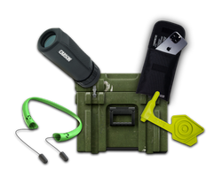
If you have survival caches buried or stored in remote locations, a small, motion-activated GPS tracker can alert you if the cache is disturbed, and Supply Drop - General IX shows a compact GPS tool in a past crate.
Emergency Signaling and Search and Rescue (SAR)
When things go sideways in the backcountry, a GPS-enabled emergency device is your most direct line to help.
Satellite Messengers vs. PLBs
There are two main types of emergency GPS devices:
- Personal Locator Beacons (PLBs): These are high-power devices that send a "help" signal directly to government satellites. They do not require a subscription but are for life-or-death emergencies only.
- Satellite Messengers: Devices like the Garmin inReach or Zoleo allow for two-way texting via satellite. They use GPS to embed your exact coordinates in every message, making it easy for SAR teams to find you.
SOS Functionality
Most dedicated tactical trackers now include a physical SOS button. When pressed, it broadcasts your location to a monitoring center that coordinates with local emergency services. In a survival situation where you may be incapacitated or injured, this one-touch capability is a lifesaver.
Key Takeaway: GPS is a force multiplier for situational awareness. It enables precise navigation, team coordination, and rapid asset recovery, provided the user understands the limitations of satellite signals and battery life.
Technical Considerations for Gear Selection
Not all GPS devices are created equal. When selecting gear for your kit, you need to evaluate it based on the environment you operate in.
Connectivity Types
- Cellular-Linked Trackers: These use GPS to find their location but rely on cell towers to send that data to your phone. These are great for vehicle tracking in urban or suburban areas but useless in the deep woods.
- Satellite-Linked Trackers: These use satellites for both location and communication. They work anywhere on Earth but usually require a monthly subscription and have a higher hardware cost.
- Bluetooth/Proximity Tags: Devices like Apple AirTags are not true GPS trackers. They rely on nearby smartphones to report their location. They are excellent for finding lost keys but unreliable for tactical asset recovery in remote areas.
Battery Management
GPS is power-hungry. A device that pings its location every 30 seconds will die much faster than one that pings every 10 minutes. The same logic applies to EDC flashlights: the more often you push a device to perform, the more carefully you need to think about power.
- Hardwired: Best for vehicles. No battery to charge.
- Rechargeable Internal: Common in handheld units. Usually lasts 15–40 hours of active use.
- Replaceable Lithium: Best for long-term survival gear. Lithium batteries perform better in extreme cold than alkaline or internal Li-Po batteries.
Durability Standards
Tactical gear needs to be rugged. Tactical gear should be built to handle abuse. Look for an IP67 or IP68 rating.
- IP67: Can be submerged in 1 meter of water for 30 minutes.
- IP68: Dust-tight and protected against continuous submersion.
- MIL-STD-810G: This is a military standard for shock, vibration, and temperature extremes.
Step-by-Step: Setting Up a GPS Tracking System for Your Vehicle
If you are looking to secure a primary bug-out vehicle or a daily driver, follow this process to ensure the system is reliable.
Step 1: Choose your power source. Decide between a plug-and-play OBD-II (On-Board Diagnostics) tracker or a hardwired unit. Hardwired units are more discreet and harder for a thief to find and unplug.
Step 2: Position the antenna. GPS signals cannot pass through metal effectively. If you are hiding a tracker inside a vehicle, place it under the plastic dashboard or near a window. Avoid placing it directly under the metal roof or deep in the engine block.
Step 3: Configure Geofencing. Open the tracking app and set a "Home" zone. Set the alert sensitivity so you get a push notification the moment the vehicle moves more than 100 yards from your driveway.
Step 4: Test the signal. Drive the vehicle in different environments—under heavy tree cover, through a city, and in an open field. Check the app to ensure the "pings" are accurate and the refresh rate is sufficient for real-time tracking.
Step 5: Establish a recovery plan. Know exactly how to share a "Live Tracking" link with law enforcement. Having the data is useless if you cannot provide it to the people authorized to recover the vehicle.
Integrating GPS into Your EDC
Everyday Carry (EDC) is about being prepared for the most likely scenarios. Including a GPS component in your EDC does not necessarily mean carrying a bulky handheld unit.
- The Watch: Many modern tactical watches include GPS. These are excellent for recording a path during a run or hike and providing a quick coordinate check without pulling out a phone.
- The Phone: Your smartphone is a powerful GPS tool, provided you download offline maps. Apps like OnX Backroads or Gaia GPS allow you to use the phone’s GPS chip even when you have zero cell service.
- The Mini Tracker: We often see members of our community use the Captain tier level gear to round out their EDC. This tier frequently features high-value tools that can include compact tracking or signaling devices suitable for a go-bag.
Field Note: In a SHTF (Sensation Hits The Fan) scenario, do not rely on the cellular network. If the towers go down, your phone's mapping app may stop working unless you have already downloaded the map data for your entire region.
Common Myths and Mistakes
Myth 1: GPS works underground. It doesn't. Satellite signals are relatively weak. They cannot penetrate significant amounts of earth, concrete, or metal. If a stolen car is driven into a deep underground parking garage, the signal will likely be lost until the car exits.
Myth 2: GPS can be used to listen to you. Standard GPS is a one-way "receive only" system. The satellites don't "see" you; your device "hears" them. However, if you are using a tracker that transmits its location via cellular or satellite, that transmission can be intercepted or tracked by the service provider.
Mistake: Forgetting to update firmware. GPS satellites occasionally have their "almanac" (data about their orbits) updated. If your device hasn't been turned on in months, it may take 10–20 minutes to get a "cold start" fix. Turn your gear on and let it sync before you head out on a mission.
Mistake: Relying on a single device. Electronics fail. Screens crack. Batteries leak. In a survival situation, your GPS is your primary tool, but your map and compass are your insurance policy.
The Future of GPS and Tactical Tech
As we look toward the future of tactical gear, we see GPS becoming more integrated into everything from optics to body armor. We are seeing the rise of "Assisted GPS" and "Real-Time Kinematics" (RTK) which can bring accuracy down to the centimeter level. This is already being used in high-end drone operations and precision surveying.
For the average operator, the focus remains on reliability and battery life. We are constantly testing new hardware to see which units can survive the abuse of the field while maintaining a rock-solid signal. This is the core of what we do at Crate Club—finding the gear that actually works when the lights go out.
Bottom line: GPS is the primary tool for modern navigation and asset security, but it requires a clear view of the sky, a charged battery, and a user who understands its technical limitations.
Summary Checklist for Tactical GPS Use
- Verify your device supports MGRS coordinates for tactical mapping.
- Download offline maps for your operational area before deployment.
- Test your geofencing alerts to ensure they trigger correctly on your phone.
- Pack extra lithium batteries or a high-capacity power bank for long-duration missions.
- Ensure your hardware has at least an IP67 rating for water and dust resistance.
- Practice navigating with a map and compass to maintain your manual skills.
Conclusion
GPS technology has moved from a secretive military project to an essential part of the modern prepper's and operator's toolkit. Whether you are using it to navigate a ruck march, secure your truck, or ensure your team stays coordinated, the value of precise location data cannot be overstated. However, a tool is only as good as the person wielding it. You must understand the difference between cellular trackers and satellite messengers, the impact of environment on signal strength, and the importance of redundant manual navigation skills.
At Crate Club, we believe in being prepared for any contingency. Our crates are curated by Spec Ops veterans who have used this technology in the most demanding environments on Earth. We provide the gear that helps you stay a step ahead, whether you are just starting your preparedness journey with our Lieutenant tier or looking for professional-grade equipment in our General tier. Use this technology to empower your movement and protect your assets, but always keep your skills sharp.
To start building your tactical kit with gear that has been hand-selected and field-tested by professionals, head over to our subscribe page and choose the tier that fits your mission.
FAQ
Does GPS work without a cellular signal?
Yes, the Global Positioning System itself does not require cellular towers; it communicates directly with satellites. However, if you are using a phone for navigation, you must download "offline maps" ahead of time, as the phone usually needs the internet to load the visual map images behind your GPS coordinates.
What is the difference between an AirTag and a GPS tracker?
An Apple AirTag uses Bluetooth to ping off nearby iPhones to report its location, making it great for urban areas but useless in the wilderness. A true GPS tracker uses satellite signals to determine its location and often uses cellular or satellite networks to transmit that data anywhere in the world, regardless of nearby people.
How long does the battery last on a mini GPS tracker?
Battery life depends entirely on how often the device updates its location. A tracker set to update every 30 seconds may only last 2–5 days, while one set to update once a day can last for several months or even years on a single charge or set of batteries.
Can GPS be jammed or spoofed?
Yes, GPS signals are weak and can be disrupted by electronic jamming devices or "spoofed" to show an incorrect location. This is why military and law enforcement operators are trained to recognize signal interference and always maintain proficiency with traditional map and compass navigation.
Share this article