Can GPS Work Without Internet? Tactical Navigation Guide
Table of Contents
- Introduction
- The Science of Satellite Navigation
- The Map Data Disconnect
- Tactical Considerations for GPS Use
- The Analog Fail-Safe: Topographic Maps
- Building Your Navigation Loadout
- Practical Steps for Offline Readiness
- Advanced Techniques: Beyond the Blue Dot
- Common Myths About GPS
- Conclusion
- FAQ
Introduction
You are deep in the backcountry, miles from the nearest cell tower, or perhaps you are operating in a dense urban environment during a localized grid failure. You pull out your smartphone or handheld device and see those dreaded words: "No Service." For many, this triggers a sense of panic. The assumption is that once the bars disappear, so does your ability to navigate. However, a seasoned operator knows that a data connection is a luxury, not a requirement. At Crate Club, we emphasize that true preparedness means knowing how your tools function when the infrastructure around them crumbles.
This guide breaks down the technical reality of how Global Positioning System (GPS) technology functions independently of cellular networks. We will cover the difference between satellite signals and map data, how to prepare your digital tools for offline use, and why traditional analog navigation remains a non-negotiable backup. Understanding whether can GPS work without internet is the first step in ensuring you never truly lose your way. If you are building a broader preparedness system, you can also choose your Crate Club tier for curated tactical and survival equipment.
Quick Answer: Yes, GPS works entirely without an internet or cellular connection. GPS receivers listen for radio signals from a constellation of satellites orbiting Earth, which requires no data transmission from your device; however, you must download offline maps beforehand to see your location on a visual interface.
The Science of Satellite Navigation
To understand why GPS works without the internet, you have to understand what GPS actually is. GPS stands for Global Positioning System. It is a U.S.-owned utility that provides users with positioning, navigation, and timing (PNT) services. This system consists of three segments: the space segment, the control segment, and the user segment.
The space segment is a constellation of over 24 satellites orbiting the Earth at approximately 12,000 miles. These satellites are constantly broadcasting radio signals. Your GPS receiver—whether it is in a dedicated Garmin unit, a watch, or your smartphone—is essentially a high-tech radio. It does not "talk" to the satellites; it only listens.
Trilateration: The Math of Positioning
When your device listens to these signals, it is performing a process called trilateration. Each satellite signal contains the satellite's location and the exact time the signal was sent. By calculating the time it took for the signal to arrive, your device determines its distance from that satellite.
- One Satellite: Your device knows it is somewhere on a sphere around that satellite.
- Two Satellites: The intersection of two spheres creates a circle of possible locations.
- Three Satellites: The intersection of three spheres narrows your position down to two points (one of which is usually impossible, like being in deep space).
- Four Satellites: A fourth satellite provides altitude data and synchronizes the device’s internal clock with the atomic clocks on the satellites.
None of this requires a cell tower or a Wi-Fi router. As long as your device has a clear line of sight to the sky, it can calculate your coordinates. For another look at offline positioning, read how GPS watches work without internet.
The Role of A-GPS
In a tactical or civilian environment, you may notice that your phone finds your location faster when you have service. This is due to Assisted GPS (A-GPS). A-GPS uses cellular data to quickly download the "Almanac" and "Ephemeris" data—the orbital maps that tell your phone where the satellites should be. Without the internet, your device has to wait to download this data directly from the satellites, which is a much slower transmission. This is known as a "Cold Start," and it can take several minutes.
Field Note: If you are moving into a comms-dark environment, turn on your GPS while you still have a data connection. This allows the device to acquire the latest satellite orbital data (ephemeris) via the internet, ensuring a much faster lock once you lose service.
The Map Data Disconnect
If GPS works without the internet, why does your map screen sometimes go blank when you lose service? This is the most common point of confusion for those new to field navigation.
Your GPS receiver provides the coordinates (the blue dot). The map data (the roads, topographical lines, and satellite imagery) is a separate layer. Most modern apps, like Google Maps or Apple Maps, "stream" map tiles in real-time. When the internet goes out, the blue dot is still there, but it is floating in a sea of gray because the device cannot download the visual map.
Solving the Blank Screen: Offline Maps
To make a smartphone a viable tactical tool, you must front-load your data. This involves downloading map sections to your device’s local storage. There are several professional-grade apps used by hunters, veterans, and preppers that specialize in this:
- OnX Hunt / Backcountry: Excellent for property boundaries and detailed topo maps.
- Gaia GPS: The gold standard for trail data and multiple map layers (USGS, satellite, etc.).
- Google Maps (Offline Mode): Useful for urban navigation, though limited in topographical detail.
By downloading these maps before you leave the wire, your device will overlay your satellite-verified coordinates onto the stored map data. This provides full navigation capability without a single bar of cell service. You can also browse the Gear Shop for equipment that complements an offline navigation setup.
Dedicated GPS Hardware
While smartphones are convenient, they are secondary tools for many in our community. Dedicated handheld GPS units, like the Garmin GPSMAP series, are built with internal storage that already contains base maps. These devices often have superior antennas and are ruggedized for the field. Many of the high-level kits we curate at our Major tier include tools that prioritize this kind of hardware reliability.
Bottom line: Your coordinates come from the sky; your maps come from the internet. Download your maps ahead of time to bridge the gap.
Tactical Considerations for GPS Use
In a tactical or SHTF (Sexting Hits The Fan) scenario, relying on GPS involves more than just knowing your location. You must consider your electronic signature and battery longevity.
EMCON and Stealth
EMCON, or Emission Control, is the practice of managing your electronic footprint to avoid detection. While a GPS receiver is "passive" (it only receives signals), a smartphone is "active" (it constantly searches for cell towers and Wi-Fi). Even if you have no service, your phone is screaming "I am here" to any nearby receiver or IMSI catcher.
If you are in a situation where signal stealth matters, you should put your device in Airplane Mode but keep Location Services (GPS) turned on. Most modern smartphones allow the GPS chip to function even when the cellular and Wi-Fi radios are disabled. This significantly reduces your electronic signature while maintaining navigation. For a broader look at reliable backup navigation, explore why compasses remain important for survival.
Power Management
GPS is a power-hungry feature. Constantly calculating satellite pings will drain a battery faster than almost any other task.
- Limit Screen Time: Check your position, then turn the screen off.
- External Power: Always carry a dedicated power bank or solar charger.
- Cold Weather: Batteries die significantly faster in the cold. Keep your GPS device close to your body to maintain its temperature.
The Analog Fail-Safe: Topographic Maps
Digital tools are force multipliers, but they are also single points of failure. An Electromagnetic Pulse (EMP), a dead battery, or a software glitch can turn your $600 handheld into a paperweight. This is why we advocate for every member of the Crate Club community to master the topographic (topo) map and compass. The Captain tier is a practical option for building a balanced field kit around everyday preparedness.
Understanding Topography
A topographic map is a two-dimensional representation of a three-dimensional landscape. While a standard road map shows you how to get from point A to point B, a topo map tells you what the terrain looks like in between.
Contour Lines are the most critical feature. These are lines that connect points of equal elevation.
- Close Lines: The closer the lines are together, the steeper the terrain.
- Widely Spaced Lines: Indicate a gentle slope or flat ground.
- Index Contours: Every fifth line is usually thicker and labeled with the exact elevation.
- V-Shapes: When contour lines form a "V," they usually indicate a valley or a ridge. If the point of the "V" points uphill, it is a valley (often with a stream). If it points downhill, it is a ridge.
For more practice identifying terrain, see how to read a topographic map.
Map Scale and Detail
The scale of the map determines how much detail you see. A common scale for tactical use is 1:24,000. This means one inch on the map represents 24,000 inches (2,000 feet) on the ground. A "large scale" map covers a smaller area with more detail, while a "small scale" map covers a larger area with less detail. For local movement, you want the detail provided by 1:24,000 (USGS Quadrangles).
Magnetic Declination
Your compass points to Magnetic North, but your map is oriented to True North (the North Pole). The difference between these two is called Magnetic Declination. This varies depending on where you are in the world. For example, in parts of Washington state, the declination might be 15 degrees East. If you do not account for this, walking 10 miles could put you nearly 3 miles off your target. Most quality compasses allow you to "set" the declination so your readings match your map perfectly. Review how magnetic declination affects compass readings before setting out.
Key Takeaway: Digital GPS tells you where you are; a topographic map tells you where you can actually go. Use them in tandem to avoid walking into impassable cliffs or marshes.
Building Your Navigation Loadout
Preparedness is about layers. You do not rely on one tool for fire, and you should not rely on one tool for navigation. When we look at gear tiers, we see navigation as a foundational skill that requires specific equipment.
The Entry-Level Navigator (Lieutenant Tier)
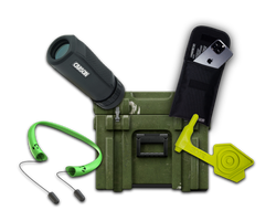
For those just getting started, your loadout should focus on the basics of EDC (Everyday Carry). This includes a reliable smartphone with offline maps pre-downloaded and a high-quality backup battery. A simple button compass or a baseplate compass should be in your kit as a primary backup. The Lieutenant What's Inside page shows the kind of essential gear suited to a beginner loadout.
The Standard Operator (Captain Tier)
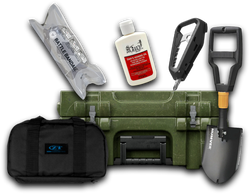
This is our most popular level of preparedness. Here, you should integrate dedicated medical kits (IFAK - Individual First Aid Kit) and more robust navigation tools. A Captain-level loadout often includes ruggedized EDC packs that can house a full-sized USGS topo map of your local "grid square" (a specific area on a map grid). For compact navigation tools, read how to use a button compass.
The Advanced Tactician (Major and General Tiers)
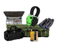
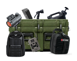
At the Major and General levels, we move into professional-grade equipment. This includes high-lumen tactical lights for night navigation and advanced optics. At the General tier, you are looking at real-issue tactical gear—tools that allow for long-range scouting and precise land navigation in the most hostile environments. You can explore the General tier to see its professional-grade equipment profile.
Practical Steps for Offline Readiness
You should not wait for a crisis to test your offline navigation. Follow these steps to ensure you are ready before you head out.
Step 1: Download Offline Areas / Open your navigation app of choice while on Wi-Fi and download the maps for your entire county and surrounding areas.
Step 2: Sync Ephemeris Data / Open your GPS app 10 minutes before leaving home to ensure it has the latest satellite data from the internet.
Step 3: Test in Airplane Mode / Turn off your cellular data and Wi-Fi, then try to navigate to a local landmark. If the map doesn't load, you haven't downloaded enough data.
Step 4: Verify Your Analog Backup / Print or buy a physical topo map of your area and ensure your compass is set to the correct local declination.
For a practical map-and-compass workflow, follow this guide to using a compass and map effectively.
Field Note: Nature shifts. Trails wash out, and landmarks change. Always check the "date of production" on your topo maps. A map from 1982 might show a spring or a trail that hasn't existed for twenty years.
Advanced Techniques: Beyond the Blue Dot
Once you are comfortable with basic GPS and map reading, you can move into more advanced tactical navigation.
The Pace Count
If both your GPS and your compass fail, you need to know how far you have traveled. This is done through pace counting. You determine how many double-steps (every time your left foot hits the ground) it takes you to cover 100 meters. You carry "pace beads" on your pack; every time you hit your count, you pull a bead. This allows you to track distance accurately across rugged terrain.
Dead Reckoning
Dead reckoning is the process of calculating your current position by using a previously determined position and advancing that position based upon known or estimated speeds over elapsed time and course. It is a vital skill for nighttime operations or movement through dense fog and forest where visual landmarks are non-existent.
Resection and Intersection
If you have a map and a compass but do not know exactly where you are, you can use Resection. You identify two visible landmarks on the horizon that are also on your map, like a specific peak and a water tower. You take a bearing on both, draw those lines on your map, and where they intersect is your location. For more detail on these techniques, read how to use a lensatic compass with a map.
Common Myths About GPS
Myth 1: GPS requires a monthly subscription.
While some apps have subscriptions for "premium" layers, the GPS signal itself is free to everyone. It is a utility provided by the U.S. government.
Myth 2: Clouds block GPS signals.
Heavy storm clouds can slightly degrade the signal, but GPS radio waves generally pass through clouds, glass, and plastic. They do NOT pass through solid rock, metal, or dense earth, like inside a cave or deep basement.
Myth 3: GPS is always 100% accurate.
Standard civilian GPS is usually accurate to within 3 to 5 meters. However, in "urban canyons," streets with tall buildings, or deep valleys, signals can bounce off walls, causing "multipath interference" which can put your blue dot blocks away from your actual location.
Bottom line: Trust your eyes and your map over the screen if the two conflict. Digital maps can glitch; the terrain does not.
Conclusion
Can GPS work without the internet? Absolutely. The satellites don't care about your data plan. However, your ability to use that GPS signal effectively depends entirely on your preparation. By downloading offline maps, managing your power, and maintaining a physical map and compass as a backup, you ensure that you remain mobile and informed in any scenario.
True tactical readiness isn't about having the most expensive gadgets; it's about understanding how your gear works when the supporting systems fail. Our mission at Crate Club is to put professional-grade tools in your hands and the knowledge in your head to use them. Whether you are a Lieutenant just starting your preparedness journey or a General looking for the highest-caliber gear, get a crate delivered monthly and build a robust navigation kit as part of the operator mindset.
FAQ
Does my phone use data when using GPS?
If you have not downloaded offline maps, your phone will use data to load the map imagery as you move. However, the GPS signal itself is free and does not use any data from your cellular plan.
Can I be tracked if my GPS is on but I have no internet?
GPS is a passive receiving technology, meaning your device does not transmit to the satellites. However, if your cellular radio is on, your phone is constantly communicating with towers, which can be used to track your location regardless of GPS status.
Why does my GPS take so long to find me when I am offline?
This is known as a "cold start." Without an internet connection to quickly download satellite orbital data (A-GPS), your device must wait to receive that data directly from the satellites, which can take several minutes of clear sky exposure.
Will a GPS work in a remote forest or desert?
Yes, as long as you have a relatively clear view of the sky. GPS works in the most remote corners of the globe, from the middle of the ocean to the Sahara Desert, because the satellite constellation covers the entire planet.
Share this article