What Are GPS Waypoints? A Comprehensive Guide
Table of Contents
- Introduction
- What Are GPS Waypoints?
- How GPS Waypoints Work
- Applications of GPS Waypoints
- Creating and Managing Waypoints
- Practical Tips for Using GPS Waypoints
- The Importance of GPS Waypoints in Tactical Situations
- Crate Club’s Role in Your Navigation Preparedness
- Conclusion
- FAQs
Introduction
Imagine you're on a hike in the wilderness, navigating through dense forests and rugged terrains. You pull out your GPS device or smartphone, and with a few taps, you access a precise location that can lead you to your destination. This is made possible through GPS waypoints—essential markers that help you navigate effectively in both familiar and unfamiliar territories.
GPS waypoints are more than just coordinates on a map; they are crucial tools used in various applications, from outdoor adventures like hiking and geocaching to military operations and professional land surveying. Understanding what GPS waypoints are and how to utilize them can significantly enhance your navigation skills and overall experience in the great outdoors.
In this blog post, we'll dive deep into the concept of GPS waypoints, exploring their significance, how they work, and practical applications. By the end, you'll have a thorough understanding of GPS waypoints and the confidence to use them in your own adventures.
We'll cover the following topics:
- What are GPS Waypoints?
- How GPS Waypoints Work
- Applications of GPS Waypoints
- Creating and Managing Waypoints
- Practical Tips for Using GPS Waypoints
- The Importance of GPS Waypoints in Tactical Situations
- Crate Club’s Role in Your Navigation Preparedness
- Conclusion
- FAQs
What Are GPS Waypoints?
At its core, a GPS waypoint is a specific point on the earth's surface defined by its geographic coordinates—latitude and longitude. These coordinates allow individuals to pinpoint a precise location on a map, making navigation straightforward.
Definition and Characteristics
-
Geographic Coordinates: Each waypoint is defined by a pair of coordinates. Latitude indicates how far north or south a point is from the equator, while longitude indicates how far east or west a point is from the prime meridian.
-
Markers: Waypoints serve as markers that can represent various locations, such as an interesting spot on a hiking trail, a campsite, or a point of interest like a waterfall or scenic overlook.
-
Versatility: They can be used in various formats, including decimal degrees or degrees, minutes, seconds, depending on the device or application being used.
Importance of Waypoints
GPS waypoints are vital tools for navigation, providing users with the ability to:
- Find Locations: Easily locate specific sites, such as campsites or trailheads.
- Plan Routes: Create routes that connect several waypoints for hiking, biking, or driving.
- Safety: Mark important locations for safety, such as emergency extraction points or landmarks.
How GPS Waypoints Work
Understanding how GPS waypoints function is essential for effective navigation. This section breaks down the mechanics behind them.
GPS Technology
GPS, or Global Positioning System, relies on a network of satellites orbiting the Earth. These satellites continuously transmit signals that GPS receivers use to calculate their position. Here's how it works:
-
Signal Transmission: GPS satellites send out signals containing their location and the exact time the signal was transmitted.
-
Signal Reception: A GPS receiver picks up signals from multiple satellites (at least four for accurate positioning).
-
Triangulation: By determining the time it takes for signals to reach the receiver, the GPS calculates how far away each satellite is, allowing it to pinpoint its exact location through a process called triangulation.
Setting Waypoints
Creating a waypoint typically involves the following steps:
-
Position Acquisition: The GPS device or smartphone acquires the user's current location using the satellite signals.
-
Waypoint Creation: The user can save this position as a waypoint, often with an option to label it or add notes (e.g., "Campsite" or "Water Source").
-
Navigation: Once waypoints are stored, users can easily navigate to them using the GPS device's mapping interface.
Applications of GPS Waypoints
GPS waypoints have diverse applications across various fields. Here are some of the most common uses:
Outdoor Activities
-
Hiking and Camping: Waypoints help hikers navigate trails, marking significant locations such as campsites or trail junctions.
-
Geocaching: This popular outdoor activity involves using GPS to find hidden caches, with each cache location marked by a waypoint.
-
Fishing and Boating: Anglers often use waypoints to mark productive fishing spots, while boaters can mark safe docking areas.
Professional Uses
-
Land Surveying: Surveyors use GPS waypoints to define property boundaries and significant points for mapping and planning.
-
Agriculture: Farmers utilize GPS waypoints for precision agriculture, marking locations for planting, irrigation, and harvesting.
-
Emergency Services: First responders use waypoints to navigate to emergencies quickly, ensuring they reach the right location without delay.
Military Applications
In military contexts, GPS waypoints are crucial for:
-
Navigation: Troops use waypoints for tactical movements and mission planning.
-
Targeting: Military operations often involve marking strategic locations for reconnaissance or direct action.
Creating and Managing Waypoints
Creating and managing waypoints is a skill that can enhance your navigation proficiency. Here are some steps and tips for effectively working with waypoints.
Devices and Applications
Different devices and applications can be used to create waypoints:
-
GPS Handheld Devices: These are dedicated GPS devices designed for outdoor navigation, often featuring robust mapping capabilities.
-
Smartphones: Many smartphone apps offer GPS waypoint functionality, allowing users to create, label, and manage waypoints easily.
Steps to Create a Waypoint
-
Access GPS Device/App: Open your GPS device or the relevant app on your smartphone.
-
Find Your Location: Ensure that the device can acquire a GPS signal and determine your current location.
-
Save the Waypoint: Look for an option to save or mark the current location as a waypoint. This may involve pressing a button or selecting an option in the app.
-
Label and Add Details: If possible, add a name and any relevant notes about the waypoint for future reference.
Managing Waypoints
-
Editing: Most GPS devices and apps allow you to edit waypoints, changing their names or adding details as needed.
-
Deleting: If a waypoint is no longer necessary, you can delete it to keep your list organized.
-
Organizing: Some applications enable users to categorize waypoints based on activities (e.g., hiking, fishing), making it easier to access relevant locations.
Practical Tips for Using GPS Waypoints
To make the most of your GPS waypoints, consider these practical tips:
Plan Your Route
Before heading out, plan your route using your waypoints. This ensures that you have a clear understanding of your journey and can anticipate any challenges.
Regularly Test Your GPS Device
Ensure that your GPS device or smartphone is functioning correctly before embarking on your adventure. Regular testing helps avoid issues when you need it most.
Stay Updated
Keep your GPS device's maps and software up to date. This ensures you have the latest information, including any new trails or points of interest.
Use Backup Methods
While GPS is reliable, it's wise to carry a physical map and compass as a backup, particularly in remote areas where signals may be weak.
Engage with the Community
Join forums or groups related to your outdoor activities. Sharing waypoint information with others enhances your knowledge and helps you discover new locations.
The Importance of GPS Waypoints in Tactical Situations
For tactical enthusiasts and professionals, GPS waypoints play a critical role in preparedness and operational efficiency. Here’s how they can be utilized effectively in various tactical scenarios.
Strategic Planning
In tactical operations, waypoints can be used to plan routes for personnel or equipment, ensuring that all team members reach designated locations efficiently.
Coordination and Communication
Waypoints enhance communication among team members. By sharing waypoint information, teams can coordinate their movements and maintain situational awareness.
Emergency Preparedness
In emergency situations, knowing where key locations are—such as safe zones or extraction points—can make a significant difference. GPS waypoints provide precise information that can be crucial in high-pressure scenarios.
Crate Club’s Role in Your Navigation Preparedness
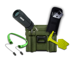
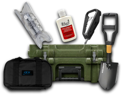
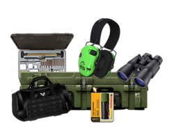
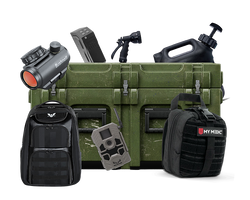
As a leader in providing high-quality tactical gear and survival tools, Crate Club understands the importance of preparedness in outdoor adventures and tactical situations. Our subscription services offer a curated selection of gear that can enhance your navigation and survival skills.
Subscription Tiers
-
Lieutenant Tier ($49.99/month) - Ideal for beginners, this tier includes essential survival and EDC gear.
-
Captain Tier ($99.99/month) - For those looking for a robust mix of tactical gear, this tier offers survival tools, outdoor essentials, and more.
-
Major Tier ($199.99/month) - Designed for experienced survivalists, this tier includes premium gear that has passed extensive testing.
-
General Tier ($399.99/Quarterly) - This top-tier subscription provides real-issue tactical gear used by professionals, ideal for those who demand the best.
Explore our offerings today and find the right gear to complement your navigation skills: Crate Club Subscription Services.
Shop for Gear
In addition to our subscription services, our Crate Club Shop provides a wide range of tactical gear and survival tools that can enhance your outdoor experiences and preparedness.
Conclusion
GPS waypoints are indispensable tools for navigation, serving a broad spectrum of applications from outdoor adventures to professional uses. By understanding what GPS waypoints are, how they work, and their various applications, you can enhance your navigation skills and ensure you're well-prepared for your next adventure.
Whether you're hiking through the wilderness, geocaching with friends, or planning a tactical operation, knowing how to effectively use GPS waypoints can make all the difference. With the right gear and knowledge, you can navigate with confidence and safety.
As you embark on your adventures, remember that preparation is key. Explore Crate Club’s subscription services and shop to equip yourself with high-quality gear that aligns with your tactical needs.
FAQs
What is a GPS waypoint?
A GPS waypoint is a specific point defined by geographic coordinates (latitude and longitude) that can be saved and used for navigation.
How do I create a waypoint?
You can create a waypoint using a GPS device or smartphone app by acquiring your current location and saving it as a waypoint, often allowing you to label it for future reference.
What are some applications of GPS waypoints?
GPS waypoints are used in outdoor activities like hiking and geocaching, as well as in professional fields such as land surveying and agriculture.
How do I manage my waypoints?
You can manage your waypoints by editing, deleting, and organizing them through your GPS device or app.
Why are GPS waypoints important in tactical situations?
In tactical situations, GPS waypoints facilitate strategic planning, coordination, and emergency preparedness, ensuring teams can navigate effectively.
By understanding and utilizing GPS waypoints, you can significantly enhance your navigation and preparedness skills, paving the way for successful and safe adventures in the great outdoors.
Share this article