Can GPS Work Underground? Tactical Realities and Navigation Tech
Table of Contents
- Introduction
- The Physics of the GPS Signal
- Material Penetration and Signal Loss
- GPS Performance in Near-Underground Environments
- Tactical Alternatives for Subterranean Navigation
- Understanding Coordinates Underground
- Gear Selection for Subterranean Ops
- Conclusion
- FAQ
Introduction
In a tactical environment, the transition from an open field to a subterranean structure is a moment of immediate technological "darkness." Whether you are clearing a basement, navigating a reinforced bunker, or operating in a tunnel network, the digital tether to the Global Positioning System (GPS) often snaps the moment you move under cover. At Crate Club, we prioritize gear that works when the grid fails, and starting with the Lieutenant tier is a solid way to build redundancy. This post covers the physics of signal attenuation, the impact of various materials on satellite reception, and the tactical alternatives you need when GPS becomes a paperweight. While technology has advanced, the fundamental laws of radio frequencies remain unchanged: if the sky is blocked, the signal is compromised.
Quick Answer: Standard GPS signals cannot reliably penetrate significant layers of soil, rock, or reinforced concrete because the microwave frequencies (L-band) are easily absorbed and scattered. Underground navigation requires high-sensitivity receivers for shallow depths or manual dead reckoning and inertial navigation systems for deeper operations.
The Physics of the GPS Signal
To understand why GPS fails underground, you have to understand the nature of the signal itself. GPS is a Global Navigation Satellite System (GNSS) that relies on a constellation of approximately 24 to 31 satellites orbiting the Earth. These satellites transmit low-power radio signals on specific frequencies, primarily the L1 band (1575.42 MHz) and the L2 band (1227.60 MHz).
If you want a companion piece on how the system performs when data access disappears, take a look at Can GPS Work Without Internet?.
Line of Sight (LOS) Requirement
GPS is a line-of-sight (LOS) technology. The receiver on your wrist or in your pack must have a direct path to the satellite to calculate its position. Because these satellites are roughly 12,500 miles away, the signal that reaches Earth is incredibly faint—comparable to looking at a 25-watt lightbulb from hundreds of miles away. This low power is intentional to prevent interference with other radio systems, but it makes the signal extremely fragile.
Trilateration and Timing
A receiver calculates your position using trilateration. By measuring the exact time it takes for a signal to travel from at least four satellites to your device, the receiver can determine its latitude, longitude, and altitude. Any delay or blockage of these signals results in a "positioning error" or a total loss of lock. When you go underground, the physical mass between you and the satellites prevents these signals from reaching the antenna.
Material Penetration and Signal Loss
Different materials affect GPS signals in varying ways. In the tactical space, we categorize these effects as attenuation—the gradual loss of signal flux as it passes through a medium.
Soil and Rock Attenuation
Soil is particularly effective at blocking GPS signals because of its moisture content. Water is a highly effective absorber of microwave frequencies (the same principle used in a microwave oven). A few feet of damp earth can completely swallow an L-band signal. Dense rock, like granite or limestone found in caves, scatters the signal, making it impossible for a receiver to maintain a coherent data stream.
For a related look at underground navigation problems, see Do Compasses Work Underground?.
Reinforced Concrete and the Faraday Cage Effect
In urban tactical environments or bunkers, the primary enemy of GPS is reinforced concrete. The concrete itself provides significant attenuation, but the "rebar" (reinforcement steel) creates a partial Faraday cage. This is a grounded metal screen that blocks electromagnetic fields. Even if you are in a shallow basement with windows, the density of the surrounding infrastructure often creates a "multipath" environment, where signals bounce off walls and lead to massive inaccuracies in your reported location.
Field Note: If you are operating in an "urban canyon"—a street with tall buildings on both sides—your GPS may still work but will likely have a "multipath error." This happens when the signal reflects off a building before hitting your receiver, adding distance to the timing calculation and placing your digital icon half a block away from your actual position.
GPS Performance in Near-Underground Environments
While deep subterranean navigation is a "no-go" for standard GPS, there are "near-underground" scenarios where high-end gear can still perform.
Shallow Cover and Basements
In shallow basements or wood-frame structures, some high-sensitivity receivers can pick up enough "leakage" or reflected signals to provide a general location. However, this is never reliable for precision movement. If you are relying on a standard civilian-grade smartphone, expect a total loss of signal within seconds of entering a reinforced structure.
If you want a field-focused compass breakdown that matches this kind of hard use, read What is the Best Compass for Survival?.
Multi-GNSS and High Sensitivity Receivers
Modern tactical receivers, such as those featured in our Major and General tier crates, often utilize multiple satellite constellations simultaneously. By accessing GPS (US), GLONASS (Russia), Galileo (EU), and BeiDou (China), the receiver increases the number of available "birds" (satellites) in the sky. This doesn't help deep underground, but it significantly improves performance in the "shadow" of buildings or just inside the entrance of a cave or tunnel.
Key Takeaway: Multi-GNSS receivers provide better reliability in marginal environments (like dense forest or urban areas), but they do not bypass the fundamental physical limits of signal penetration through rock and earth.
Tactical Alternatives for Subterranean Navigation
When the GPS goes dark, an operator must revert to analog or self-contained digital systems. Navigating a tunnel or a large basement complex requires a different mindset, and it helps to browse the Gear Shop.
If you want to reinforce those fundamentals, Mastering Navigation: How to Navigate Using a Map and Compass is a strong next read.
Dead Reckoning and Pace Counting
Dead reckoning is the process of calculating your current position by using a previously determined position (your last known point or LKP) and advancing that position based on your known speed, elapsed time, and course.
- Step 1: Record your LKP. Before entering the structure or tunnel, mark your exact GPS coordinates.
- Step 2: Maintain a compass heading. Use a high-quality lensatic compass. In subterranean environments, be aware of "local attraction"—metal pipes or electrical lines that can pull your compass needle off North.
- Step 3: Track your distance. Use a pace count (the number of steps it takes you to travel 100 meters). In cramped tunnels, you may need to adjust your pace count for crawling or duck-walking.
- Step 4: Map as you go. A simple sketch map with headings and distances is often more reliable than a glitchy digital display in a bunker.
Inertial Navigation Systems (INS)
Higher-level tactical units use Inertial Navigation Systems (INS). Unlike GPS, which is an "external" reference system, INS is an "internal" system. It uses accelerometers and gyroscopes to track every movement the operator makes from a starting point. Since it does not rely on satellites, it works perfectly in deep tunnels or lead-lined bunkers. While professional-grade INS is often bulky or expensive, some high-end tactical watches and sensors are beginning to integrate basic inertial tracking to bridge the gap during short GPS outages.
Understanding Coordinates Underground
Even if your GPS doesn't work underground, you still need to understand how to communicate your position to teams on the surface. If you have mapped a tunnel 50 meters North and 20 meters East of the entrance, you need to be able to translate that back into a coordinate format they can use for extraction or fire support.
Coordinate Formats
There are three primary ways to express these points. Most operators prefer MGRS (Military Grid Reference System) for ground ops, but you should be familiar with the three standard latitude and longitude formats:
- Degrees, Minutes, Seconds (DMS): 38° 53' 23" N, 77° 00' 32" W. This is the traditional "maritime" style.
- Degrees and Decimal Minutes (DMM): 38° 53.383' N, 77° 00.533' W. Common in many handheld GPS units.
- Decimal Degrees (DD): 38.8897°, -77.0089°. The simplest format for digital data entry.
If you need a cleaner refresher on formatting and reading them, How to Read GPS Coordinates covers the basics.
Plotting from the Last Known Point (LKP)
If you know your entry point's coordinates in Decimal Degrees, you can use simple math to update your position if you move significant distances. However, for most subterranean tactical ops, you will simply report your position relative to the "Threshold" or "Entry Point."
For a broader look at coordinate use in the field, What are GPS Coordinates? is worth a read.
Field Note: Always set your device to the WGS84 (World Geodetic System 1984) datum. Using different datums between team members can result in position errors of several hundred meters—a fatal mistake in a subterranean environment.
Gear Selection for Subterranean Ops
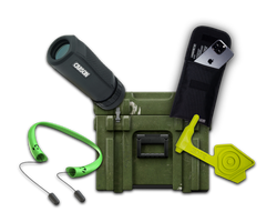
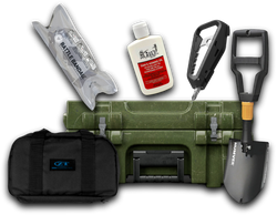
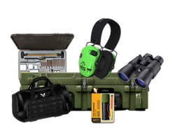
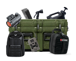
Preparation for "GPS-denied" environments starts with the gear in your kit. We curate our Captain crate to include the redundant tools necessary for these scenarios.
For a look at how illumination gear shows up in the field, read What Is a Tactical Flashlight Used For?.
| Gear Item | Purpose | Why it's Critical Underground |
|---|---|---|
| Lensatic Compass | Directional Heading | Works without battery or satellite signal. |
| Pace Beads | Distance Tracking | Keeps an accurate count of distance traveled in dark environments. |
| High-Lumen Flashlight | Visibility/Signaling | Vital for reading maps and identifying obstacles in tunnels. |
| Tactical Notepad | Mapping/Data | Recording "dead reckoning" data to ensure you can find your way out. |
| Altimeter | Vertical Tracking | Helps determine depth or floor level in multi-story underground complexes. |
If you want to see a past box that included an EDC light and optics maintenance gear, explore Supply Drop - Captain XXIV.
Redundancy is Life
The best piece of gear you can carry is the one that doesn't require a signal from space. A quality mechanical compass and a clear understanding of your pace count are the "fail-safes" every prepper and tactician should master. We've seen operators rely too heavily on their screens, only to find themselves completely disoriented when they move into a parking garage or a basement. Don't be that guy.
When you want to round out the rest of your kit, shop tactical gear that fits the mission.
For another example of a past crate built around practical field gear, see Supply Drop - General IV.
Bottom line: GPS is a luxury in the field; your compass and your brain are the requirements.
Conclusion
GPS technology is a force multiplier, but it is not a magic bullet. It fails in the very places where navigation is often most critical: inside buildings, under heavy canopy, and especially underground. By understanding the physics of signal blockage and mastering the "old school" skills of dead reckoning and pace counting, you ensure that your mission continues even when your screen goes blank. At Crate Club, we provide the field-tested tools and the veteran-led knowledge to help you navigate any environment, from the open desert to the deepest bunker. Preparation is a mindset, and part of that mindset is knowing exactly what to do when your tech hits its limit. Explore the General tier for a more advanced gear loadout.
Key Takeaway: Always mark a Last Known Point (LKP) before entering a subterranean structure and transition immediately to manual tracking to maintain situational awareness.
Build your navigation kit and stay ahead of the curve by choosing a Crate Club subscription that matches your experience level.
FAQ
Why does my GPS stop working as soon as I enter a tunnel?
GPS relies on high-frequency radio waves that travel in a straight line from satellites in orbit. These waves have very little penetrating power and are easily blocked by the mass of the earth, rock, or concrete that forms the tunnel. Once the line-of-sight to the satellites is broken, the receiver cannot calculate the timing needed for a position fix.
Can I use a signal booster to get GPS underground?
Standard signal boosters (repeaters) can work in very specific, permanent installations where an antenna is placed outside and the signal is re-broadcast inside. However, this is not a portable tactical solution. For an operator on the move, once you are deep underground, there is no signal to "boost."
Is GLONASS better than GPS for underground use?
Neither GLONASS, Galileo, nor GPS can penetrate deep underground. However, using a "multi-GNSS" receiver that tracks all these constellations simultaneously can help you maintain a signal for longer when you are in "marginal" areas, such as the mouth of a cave or a narrow urban alley, because there are more satellites available to find a gap in the cover.
How can I track my location if I'm in a deep basement?
The most reliable method is dead reckoning. Note your entry point (LKP), keep track of your compass heading for every turn you take, and count your paces to estimate distance. In high-stakes tactical environments, some units use specialized inertial sensors that track movement via internal gyroscopes, but manual mapping remains the standard backup.
Share this article