Mastering Land Nav: How to Use GPS Coordinates Like a Pro
Table of Contents
- Introduction
- The Foundation of Global Navigation
- Navigating the Three Primary Formats
- The Operator’s Standard: MGRS
- How to Input Coordinates into a Handheld GPS
- Understanding Map Datums: The Silent Killer
- Tactical Applications and Survival Scenarios
- Essential Gear for GPS Navigation
- Common Mistakes to Avoid
- Practical Training: Building the Skill
- Conclusion
- FAQ
Introduction
Whether you are humping a pack through the backwoods or calling in a medical evacuation for a downed teammate, precision is your best friend. In the field, "over there" is not a location; it is a liability. Understanding how to use GPS coordinates is the difference between a successful extraction and a long, dangerous night in the bush. GPS, or Global Positioning System, relies on a constellation of satellites to provide your exact location anywhere on the globe.
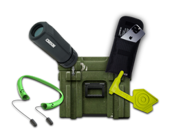
At Crate Club, we know that the best gear in the world—from high-end Garmin units to the survival tools in our Captain tier—is only as good as the operator’s ability to use it. This guide breaks down the essential skill of reading, communicating, and inputting GPS coordinates. We will cover the primary formats, the importance of map datums, and the military standards that every serious tactician needs to master. By the end of this article, you will have the knowledge to navigate any terrain with confidence.
Quick Answer: GPS coordinates are numerical values representing a specific point on the Earth's surface using a grid system. To use them, you must identify the format (Degrees, Minutes, Seconds or Decimal Degrees), input the numbers into your navigation device, and ensure your device’s Map Datum matches your source.
The Foundation of Global Navigation
To understand how to use GPS coordinates, you must first understand the grid that covers our planet. The Earth is divided into two sets of lines: Latitude and Longitude. These lines create a mathematical address for every square inch of the Earth's surface, which is why what GPS coordinates are matters before you start plotting them.
Latitude: The Horizontal Rungs
Latitude lines run east to west around the globe but measure your distance north or south of the Equator. Think of them like rungs on a ladder. The Equator is 0 degrees. The North Pole is 90 degrees North, and the South Pole is 90 degrees South. In a tactical context, these are often referred to as "parallels" because they never intersect.
Longitude: The Vertical Segments
Longitude lines run north to south, connecting the poles. They measure your distance east or west of the Prime Meridian, which passes through Greenwich, England. The Prime Meridian is 0 degrees longitude. These lines are not parallel; they are widest at the Equator and converge at the poles. In the field, these are known as "meridians."
The Concept of a Waypoint
A Waypoint is a specific set of coordinates saved in a GPS device. It represents a destination, a point of interest, or a rally point. Mastering the ability to create and share waypoints is a core requirement for any survivalist or professional operator, and it connects directly with what GPS waypoints are.
Navigating the Three Primary Formats
One of the biggest hurdles for beginners is realizing that GPS coordinates can be written in several different ways. If your buddy gives you coordinates in one format and your device is set to another, you could end up miles off target. There are three primary formats you will encounter in the field, and How to Read GPS Coordinates: A Comprehensive Guide is a solid reference for all three.
1. Degrees, Minutes, and Seconds (DMS)
This is the traditional format used in marine navigation and older topographic maps. It looks like this: 40° 44' 59" N, 73° 59' 4" W.
- Degrees (°): The largest unit of measurement.
- Minutes ('): There are 60 minutes in one degree.
- Seconds ("): There are 60 seconds in one minute.
2. Degrees and Decimal Minutes (DDM)
This is the standard format for most search and rescue (SAR) operations and handheld GPS units. It simplifies the math by replacing seconds with a decimal. It looks like this: 40° 44.983' N, 73° 59.067' W. Most operators find this the easiest to communicate over a radio.
3. Decimal Degrees (DD)
Used primarily by computer systems and web-based maps like Google Maps. It looks like this: 40.7497, -73.9844. Note that in this format, North and East are positive numbers, while South and West are negative numbers.
| Format | Example | Common Use Case |
|---|---|---|
| DMS | 38° 53' 23" N, 77° 00' 32" W | Marine & Traditional Mapping |
| DDM | 38° 53.383' N, 77° 00.533' W | Search & Rescue (SAR) & Handhelds |
| DD | 38.8897, -77.0089 | Digital Maps & Web Applications |
Key Takeaway: Always verify the coordinate format before you start your movement. Most GPS devices allow you to change the display format in the "System" or "Units" menu to match your map or orders.
The Operator’s Standard: MGRS
For the military and tactical community, Latitude and Longitude are often discarded in favor of the Military Grid Reference System (MGRS). MGRS is designed to make land navigation faster and more intuitive when using paper maps and a protractor, much like the approach covered in Mastering Navigation: How to Use a Compass and Map Effectively.
How MGRS Works
MGRS divides the world into Grid Zone Designators (GZD), such as 18S. Within those zones, it uses 100,000-meter square identifiers, like "UH." The rest of the coordinate is a string of numbers that tells you exactly where you are within that square.
Reading the Grid
The golden rule of MGRS is: Read Right, then Up. An MGRS coordinate might look like this: 18S UH 8456 2314.
- 18S: The Grid Zone Designator.
- UH: The 100km Square Identifier.
- 8456: The "Easting" (how far right you go).
- 2314: The "Northing" (how far up you go).
Precision Levels
The number of digits in an MGRS coordinate determines its accuracy.
- 4 Digits (84 23): 1,000-meter accuracy (General vicinity).
- 6 Digits (845 231): 100-meter accuracy (Standard for reporting).
- 8 Digits (8456 2314): 10-meter accuracy (Targeting and extraction).
- 10 Digits (84562 23147): 1-meter accuracy (Survey grade).
Field Note: In a survival situation, an 8-digit grid is usually the standard for "pinpoint" accuracy. It is precise enough for a helicopter to find your landing zone (LZ) without confusion.
How to Input Coordinates into a Handheld GPS
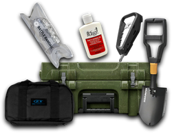
Having a high-end GPS unit from the Major tier of our subscription service is a major advantage, but you need to know the workflow. While every device varies slightly, the logic remains the same. Use these steps to input a destination or waypoint.
Step 1: Power On and Acquire Satellites
Turn your device on in an open area. A GPS needs a clear line of sight to at least four satellites to provide an accurate 3D position (including altitude). Do not trust your coordinates until your device shows a "3D Fix" or a low "Accuracy" number (under 20 feet is ideal).
Step 2: Check Your Settings
Go to the "Settings" or "Setup" menu. Ensure your Position Format matches the coordinates you were given (DMS, DDM, or MGRS). Also, ensure your Map Datum is set correctly—usually WGS84 for modern GPS use.
Step 3: Create a New Waypoint
Select "Mark Waypoint." This creates a point at your current location. To navigate elsewhere, you must edit this point. Select the waypoint, then select "Edit."
Step 4: Manually Enter the Coordinates
Highlight the coordinate field and enter the numbers for your target destination. Double-check every digit. A single wrong number in a 10-digit grid can put you on the wrong side of a mountain range.
Step 5: Save and Navigate
Save the waypoint with a clear name (e.g., "BASECAMP" or "RALLY1"). Select "Go" or "Navigate" to begin your movement. The device will give you a Bearing (direction to travel) and a Distance.
Bottom line: Practice inputting waypoints in a familiar environment before you rely on them in the wilderness. Muscle memory saves lives when the weather turns or the sun goes down.
Understanding Map Datums: The Silent Killer
A Map Datum is a mathematical model of the Earth's shape. Because the Earth isn't a perfect sphere, different models have been created over the decades. This is the most common technical error people make when using GPS coordinates, and How to Use GPS Coordinates: A Comprehensive Guide breaks down the practical side of keeping your system aligned.
WGS84 vs. NAD27
- WGS84 (World Geodetic System 1984): This is the default for almost all modern GPS units, smartphones, and digital maps.
- NAD27 (North American Datum 1927): This is found on many older paper topographic maps still in circulation.
If your GPS is set to WGS84, but you are reading coordinates off a NAD27 map, your location could be off by over 200 meters. Always check the legend of your paper map to see which datum it uses, and match your GPS settings to it.
Tactical Applications and Survival Scenarios
In the tactical world, coordinates are used for more than just finding a trail. They are the language of logistics and emergency response, which is part of the broader role described in What Is Tactical Gear Used For?
Calling for Help
If you are injured or stranded, you need to provide your coordinates to emergency services. In the US, most 911 centers can accept DDM or DD formats. If you are calling in a medical evacuation (MEDEVAC) to a military unit, you will likely use MGRS.
Land Navigation Backup
An operator never relies solely on electronics. Your GPS is a tool to verify your location on a paper map. Use your GPS to get your coordinates, then plot them on your map using a protractor. This ensures that if your device fails or the battery dies, you still know exactly where you are.
Search and Rescue (SAR)
When performing a search, coordinates allow a team to "mow the lawn"—walking precise parallel lines to ensure 100% coverage of an area. Without GPS coordinates, search patterns become erratic and leave gaps where a victim might be missed.
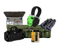
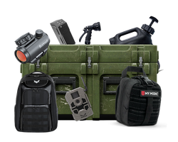
Essential Gear for GPS Navigation
Reliable navigation requires a layered approach, and a past General supply drop is a good reminder that practical field kits often include more than one kind of tool.
- Handheld GPS: A dedicated unit like a Garmin Montana or Foretrex. These are more rugged and have better battery life than smartphones.
- Compass: A high-quality lensatic or baseplate compass is a non-negotiable backup.
- Power Supply: For long missions, a portable solar charger or a high-capacity power bank is essential. The Gear Shop is a smart place to browse supporting items.
- Map and Protractor: A physical map of your area of operations (AO) and a tool to plot coordinates.
- Signal Mirror and Whistle: If your coordinates bring help to your area, you still need to "talk them in" visually or audibly.
Field Note: Cold weather kills batteries. If you are operating in freezing temperatures, keep your handheld GPS inside your inner jacket pocket to keep the battery warm. Only pull it out when you need a fix.
Common Mistakes to Avoid
Even experienced navigators can make simple errors that lead to disaster. Watch out for these pitfalls:
- Transposing Numbers: This is the most common error. Reading "45" but typing "54." Always read the numbers back out loud to a partner or yourself.
- Forgetting the Hemispheres: In the US, your Latitude is always North and your Longitude is always West. In many digital formats, "West" is indicated by a negative sign. Forgetting that minus sign can put your waypoint in China instead of Colorado.
- Ignoring the Battery: Modern GPS units are power-hungry. Always carry spare AA/AAA batteries or a verified power bank.
- Static Navigation: Do not stare at the screen while walking. Use the GPS to get a bearing, pick a landmark in the distance (like a specific tree or rock), and walk toward that landmark. This keeps your head up and aware of your surroundings.
Practical Training: Building the Skill
You cannot learn to navigate by reading alone. You need dirt under your boots.
- Go Geocaching: This is essentially a worldwide scavenger hunt using GPS coordinates. It is an excellent, low-stakes way to practice finding specific points, and it pairs well with What Are GPS Waypoints? A Comprehensive Guide.
- Practice Plotting: Buy a local USGS topographic map and a protractor. Use your GPS to find your location, then manually plot it on the map.
- Night Nav: Once you are comfortable during the day, practice finding waypoints at night. It changes your perspective and forces you to trust your gear and your math.
At Crate Club, our mission is to provide you with the gear and the knowledge to handle any situation. Whether you are a Lieutenant tier just starting your journey or a General looking for the highest grade of tactical equipment, preparation starts with mastering the fundamentals. Navigation is a perishable skill—get out there and use it.
Bottom line: Coordinates are the universal language of the wilderness. Master them, and you will never truly be lost.
Conclusion
Understanding how to use GPS coordinates is more than just a technical skill; it is a vital component of situational awareness and survival. By mastering Latitude and Longitude, learning the MGRS grid, and understanding the nuances of map datums, you elevate yourself from a casual hiker to a capable operator. Remember that gear is a force multiplier, but your brain is the primary weapon.
We take pride in delivering the tools you need to stay ahead of the curve. From the curated EDC essentials in our Lieutenant tier to the professional-grade survival equipment in our General tier, every item we send is field-tested by Spec Ops veterans. Stay prepared, stay sharp, and keep your gear ready for the mission ahead. Browse our Gear Shop or choose your subscription tier to start building your ultimate loadout today.
FAQ
What is the difference between Latitude and Longitude?
Latitude lines run east to west and measure your distance north or south of the Equator. Longitude lines run north to south and measure your distance east or west of the Prime Meridian. Together, they create a grid that can identify any point on the Earth's surface.
Why does my GPS location not match my paper map?
The most likely reason is a Map Datum mismatch. Check your paper map's legend for the datum (usually NAD27 or WGS84) and ensure your GPS unit is set to the same one in its system settings. Even a small difference in the mathematical model of the Earth can cause an error of hundreds of meters.
Is MGRS better than Latitude and Longitude?
For tactical land navigation and ground operations, MGRS is generally superior because it uses a metric-based grid that is easier to measure with a protractor on a paper map. However, for maritime or aviation use, Latitude and Longitude remain the global standard.
Can I use my smartphone for GPS coordinates in an emergency?
Yes, most smartphones have a built-in GPS chip that works even without cellular service. However, smartphone batteries die quickly, and the glass screens are fragile. For serious survival or tactical use, a dedicated handheld GPS unit is highly recommended for its durability and battery life.
Share this article