How Mini GPS Tracker Works: A Tactical Gear Overview
Table of Contents
- Introduction
- The Foundation of Global Navigation
- The Mechanism of Trilateration
- Data Transmission: The Core of a Tracker
- Understanding the Output: Latitude and Longitude
- Power Management and Form Factor
- Step-by-Step: Deploying a Mini GPS Tracker
- Map Datums: The Hidden Variable
- Tactical Considerations and Limitations
- Conclusion
- FAQ
Introduction
Whether you are tracking a high-value equipment cache or monitoring the movement of a team member in a remote environment, knowing the location of your assets is a tactical necessity. A mini GPS tracker provides this capability in a compact form factor that can be easily concealed or integrated into existing kit. At Crate Club, we prioritize gear that offers professional-grade reliability, and understanding the mechanics of these devices ensures you can deploy them effectively when the mission demands it. This article covers the satellite technology behind Global Positioning Systems (GPS), the data transmission methods used by mini trackers, and the coordinate formats required to interpret their output. By the end of this guide, you will understand how these devices bridge the gap between space-based signals and the screen in your hand.
Quick Answer: A mini GPS tracker works by receiving signals from a constellation of orbiting satellites to determine its exact coordinates through a process called trilateration. It then transmits this location data to a user via cellular, satellite, or Bluetooth networks, allowing for real-time monitoring on a smartphone or computer.
The Foundation of Global Navigation
To understand how a mini tracker functions, you must first understand the system it relies on. GPS stands for Global Positioning System. This is a network of at least 24 satellites orbiting the Earth at an altitude of approximately 12,000 miles. Developed by the Department of Defense (DOD), this system was designed to provide precise location data for military operations, including missile guidance and troop movements.
The satellites follow precise orbits, ensuring that at least four are visible from any point on Earth at any time. Each satellite transmits a low-power radio signal containing its location and the exact time the signal was sent, measured by an onboard atomic clock. The receiver in your mini tracker picks up these signals to calculate its position.
For a broader look at satellite coverage and signal limitations, explore how GPS works in different environments.
The Space, Control, and User Segments
The GPS ecosystem is divided into three distinct segments:
- Space Segment: The constellation of satellites constantly broadcasting signals.
- Control Segment: Ground stations located around the world that monitor the satellites' health and maintain their orbital paths.
- User Segment: The receiver hardware, such as the mini tracker in your gear loadout, which processes the satellite data.
Field Note: Signal "shadows" are a real threat to accuracy. Heavy tree canopy, deep canyons, or dense urban environments can block or bounce satellite signals, leading to "GPS drift" where your reported position jumps around erroneously.
The Mechanism of Trilateration
The mini tracker determines its location through a mathematical process called trilateration. Unlike triangulation, which uses angles, trilateration uses the distance between the device and multiple satellites.
When the tracker receives a signal, it calculates the "time of flight"—the exact amount of time it took for the signal to travel from the satellite to the device. Because the signal travels at the speed of light, the device can calculate its distance from the satellite.
By measuring the distance from three satellites, the tracker can narrow its position down to two points on a two-dimensional plane. A fourth satellite is required to confirm the precise three-dimensional location, including altitude, and to synchronize the device’s clock with the atomic clocks on the satellites.
For a practical explanation of location data, review this guide to mastering GPS coordinates.
Data Transmission: The Core of a Tracker
It is vital to distinguish between a GPS receiver and a GPS tracker. A simple receiver, like a handheld hiking unit, tells the person holding the device where they are. A tracker, however, must communicate that location back to a remote user. This is the "tracking" component of the hardware.
Cellular Transmission (GSM/LTE)
Most mini trackers on the market use cellular networks to transmit their coordinates. These devices contain a SIM (Subscriber Identity Module) card and a cellular modem. Once the tracker calculates its position via satellite, it sends that data through the local cellular network to a server. You then access this data through a specialized app or web portal.
Satellite Transmission
In "no-service" zones where cellular towers are non-existent, professional-grade trackers use satellite-to-satellite communication. Using networks like Iridium or Globalstar, these devices send their coordinates directly back into space to a different constellation of communication satellites. This ensures connectivity in the middle of the ocean or in deep wilderness, though it often requires a more expensive service plan.
Bluetooth and Crowdsourced Networks
Small, consumer-grade tags often use Bluetooth. These do not have a built-in GPS chip that talks to satellites. Instead, they rely on the GPS of a nearby smartphone. They "ping" off passing devices in a crowdsourced network to report their position. For serious tactical use, these are often insufficient because they rely on the presence of other people with specific apps installed.
| Tracker Type | Primary Connection | Range | Use Case |
|---|---|---|---|
| Cellular | LTE-M / 4G / 5G | Anywhere with cell service | Asset tracking, vehicle monitoring |
| Satellite | Iridium / Globalstar | Global (True 100% coverage) | Backcountry ops, maritime, remote teams |
| Bluetooth | Short-range radio | 30–300 feet | Finding keys or gear inside a building |
Bottom line: A mini GPS tracker is only as useful as its transmission method; choose cellular for urban areas and satellite for the deep bush.
When comparing tracking and communication equipment, browse the Gear Shop for additional tools that can complement your loadout.
Understanding the Output: Latitude and Longitude
Once the tracker sends its data, you are presented with coordinates. These are the mathematical addresses for a specific spot on the Earth's grid. This grid is defined by two types of imaginary lines: Latitude and Longitude.
Latitude (Parallels)
Latitude lines run east to west around the globe but measure distance north or south of the Equator. The Equator is 0° latitude. The North Pole is 90° N, and the South Pole is 90° S.
Longitude (Meridians)
Longitude lines run north to south, from pole to pole. They measure distance east or west of the Prime Meridian in Greenwich, England. The Prime Meridian is 0° longitude. These lines go up to 180° E and 180° W.
Coordinate Formats
When you receive data from your tracker, it will likely be in one of three formats. It is essential to know the difference so you can relay your position accurately to other team members or emergency services.
- Decimal Degrees (DD): The most common digital format (e.g., 40.7488, -73.9854). Positive numbers represent North/East, while negative numbers represent South/West.
- Degrees and Decimal Minutes (DDM): The standard for maritime navigation and many handheld units (e.g., 40° 44.933' N).
- Degrees, Minutes, and Seconds (DMS): The traditional format often found on paper topographic maps (e.g., 40° 44' 55" N).
Key Takeaway: Always read the Latitude (North/South) first, followed by the Longitude (East/West). Reversing these numbers will put your coordinates on the opposite side of the planet.
Power Management and Form Factor
The "mini" in mini GPS tracker presents a significant engineering challenge: balancing battery life with size. A GPS receiver and a cellular modem are both power-intensive components.
To solve this, most trackers use Interval Tracking. Instead of keeping the GPS and modem powered on 24/7, the device "sleeps" and only wakes up to take a reading and transmit at set intervals (e.g., every 5 minutes, 1 hour, or once a day). Many also include a 3-axis accelerometer, which allows the device to stay in deep-sleep mode until it detects movement. This is how a device the size of a matchbox can maintain a battery life of several weeks.
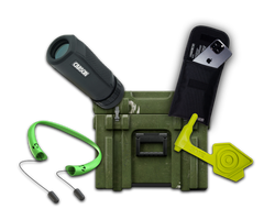
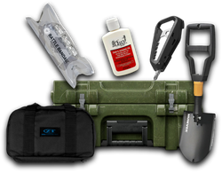
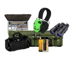
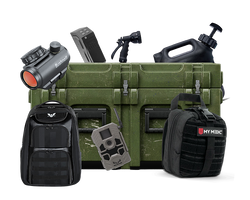
We include various navigation and tracking tools in our Captain and Major tiers because having a reliable way to monitor assets is a fundamental part of an operator's kit. As you build your loadout, consider the battery life requirements of your specific mission.
See what navigation-focused equipment can look like in the Captain tier, or explore the Major tier for a more advanced loadout.
Step-by-Step: Deploying a Mini GPS Tracker
Step 1: Configure the update interval. / Access the device settings via the provided software. Set the ping frequency based on your needs—frequent updates for a moving vehicle, or infrequent for a stationary cache—to preserve battery.
Step 2: Check the "Clear View of the Sky." / Before final deployment, ensure the device can see the horizon. If placing it on a vehicle, avoid burying it deep in the engine block; instead, mount it under a plastic bumper or in a location where the signal can pass through non-metallic materials.
Step 3: Test the transmission. / Move the device to a new location and wait for the update to appear on your dashboard. Confirm that the coordinates match your actual location before relying on the device in the field.
Step 4: Secure and conceal. / Use heavy-duty mounting tape or integrated magnets. Ensure the device is shielded from extreme heat and moisture unless it has a high IP (Ingress Protection) rating for waterproofing.
Field Note: Many operators use a "dummy" tracker in a visible location while the real mini tracker is hidden deep within the asset. If an adversary finds the dummy unit and disables it, they may stop looking, leaving the primary tracker active.
For additional ideas on organizing electronics and essentials, read what to include in a tactical loadout.
Map Datums: The Hidden Variable
A common mistake in the field is ignoring the Map Datum. Because the Earth is not a perfect sphere, scientists use mathematical models called datums to align coordinates with the actual terrain.
The global standard is WGS84 (World Geodetic System 1984). Almost all mini GPS trackers and smartphone apps use this. However, if you are transposing these coordinates onto an old paper map, that map might use NAD27 (North American Datum 1927). If your device and map aren't on the same datum, your coordinates could be off by over 200 meters. Always check the map's legend and match your device settings accordingly.
Tactical Considerations and Limitations
While mini GPS trackers are powerful tools, they are not infallible. An operator must understand the conditions that lead to failure.
- Signal Jamming: Low-cost GPS jammers can overwhelm the weak satellite signals, rendering the tracker useless.
- Battery Depletion: Cold weather significantly reduces battery capacity. In winter operations, a tracker that normally lasts two weeks might die in four days.
- IP Ratings: Ensure your device is rated for the environment. An IP67 rating means the device can survive immersion in water, which is critical for gear attached to the exterior of a pack or vehicle.
Bottom line: Never rely on a single piece of electronic gear. Use a tracker as a primary tool, but keep your manual navigation skills sharp for when the batteries fail or the signal is lost.
For a related example of compact, rechargeable equipment, explore the lighting and utility gear in Supply Drop Major XXVI.
Conclusion
A mini GPS tracker is a sophisticated piece of tactical hardware that compresses decades of Cold War satellite technology into a pocket-sized device. By understanding the relationship between the satellite constellation, the transmission networks, and the coordinate systems, you can use these tools to maintain situational awareness over your most important assets. At Crate Club, we are committed to providing the gear and the knowledge that Spec Ops veterans and professionals rely on. Whether you are starting with our Lieutenant tier or investing in the professional-grade equipment of the General tier, building your kit with intention is the first step toward true preparedness. Stay tracked, stay ready, and keep your gear mission-capable.
Start building your loadout by choosing a Crate Club subscription tier, or explore the General tier for professional-grade equipment.
FAQ
Do mini GPS trackers require a monthly subscription?
Yes, most mini trackers that use cellular or satellite networks require a monthly subscription to cover the cost of the data transmission. This is separate from the GPS signal itself, which is free to receive, but sending that data to your phone requires a paid network connection.
How accurate are mini GPS trackers in real-world conditions?
Under a clear sky, most professional mini trackers are accurate to within 3 to 10 meters. However, in "urban canyons" with tall buildings or under dense forest cover, the accuracy can degrade to 30 meters or more due to signal interference and multipath errors.
Can a mini GPS tracker work without a cellular signal?
A standard cellular tracker cannot transmit its location without a signal, though some can store coordinates internally and upload them once a connection is re-established. For areas with zero cellular coverage, you must use a tracker that utilizes a satellite network like Iridium for data transmission.
How long does the battery last on a mini GPS tracker?
Battery life varies based on the "ping" interval and battery size. A device set to update every minute may only last a few days, while a device set to update once a day—and using motion-sensing sleep modes—can often last several weeks or even months on a single charge.
Share this article